There is much to see and do in the many towns on the Fleurieu Peninsula. I have listed some of the best places to visit, whether you’re travelling as a family or solo. Whether you spend a day, weekend or longer, I’m sure you won’t be disappointed in this part of South Australia.
This post contains affiliate links. If you use these links, I receive a small commission. It doesn’t cost you anything extra, and it helps me maintain this site. Thank you.
Subscribe to my blog to stay up to date as I share more about my travel experiences.
All prices and times were accurate when this information was written or updated; however, please verify the details on the websites before your visit.
Contents
Myponga Reservoir Walk
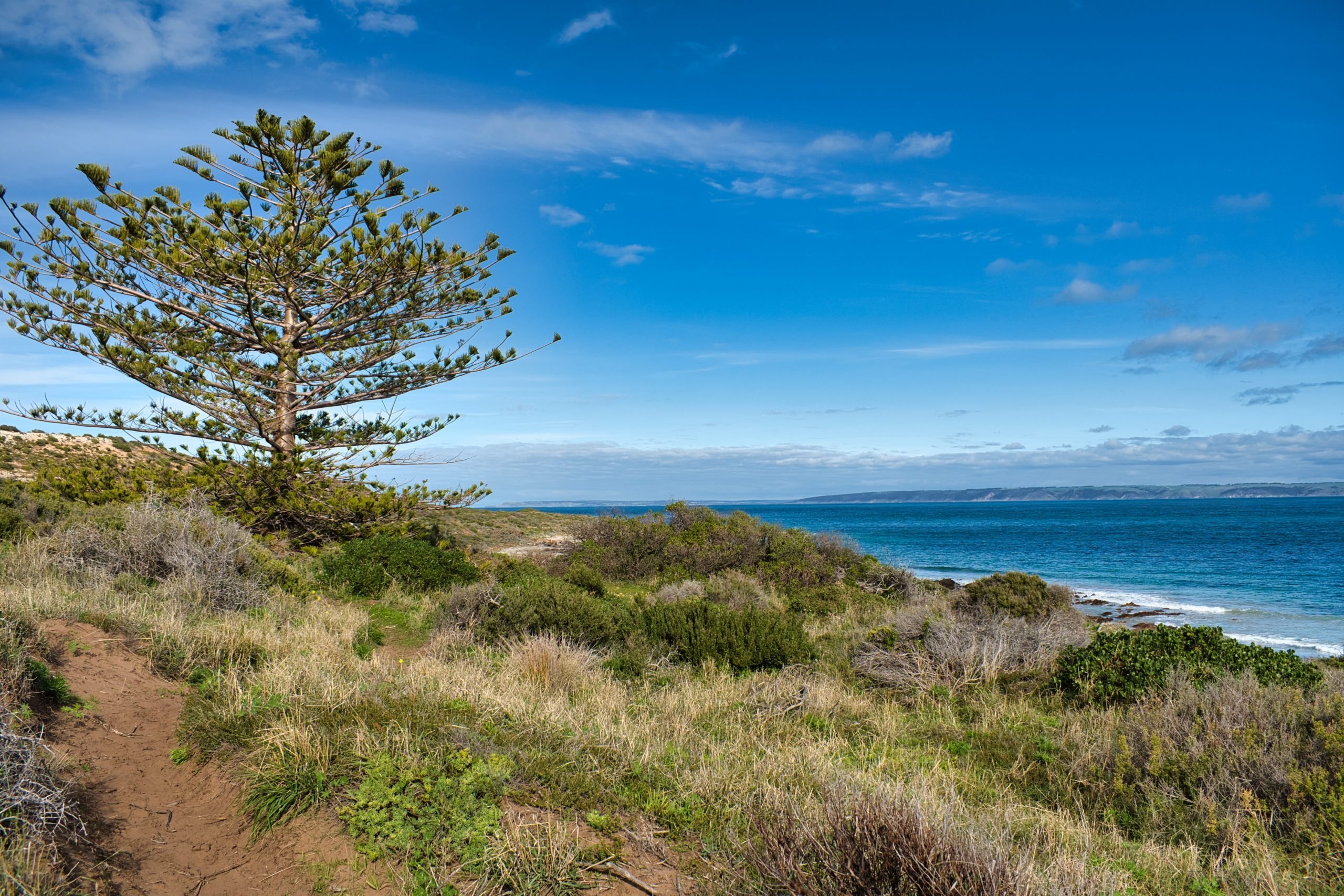
About an hour’s drive south of Adelaide is the small township of Myponga. Here, you will find the Reservoir Walk, a 3.3 km track suitable for walking and biking.

There is plenty of birdlife along the way, and you may even spot the local Kangaroos depending on the time of day you visit.

There is also artwork on the red brick pump station, visible from the end of Hansen Street.
If you don’t want to take a walk, you could go to the lookout. From the main road, watch for the signs for the turnoff to get views over the reservoir and Fleurieu Peninsula countryside.

Parking is limited, and dogs are not permitted on the premises. If you would like to fish, you need a fishing license, which you can find out about on this website.
Hours
Daylight Saving Time 7.30 am – 8 pm
Standard Time 7.30 am – 5 pm.
Closed on Christmas Day, Total Fire Ban Days, and for operational activity (gates will be closed).
There is also a water tank art on the Fleurieu Peninsula. While you are at the Reservoir, there is a water pump station that is covered in art depicting the local area, as well as a water tank across the road with art on it.


Yankalilla/Normanville
The Fleurieu Peninsula Coast Visitor Centre is in Yankalilla. Here you will find all the information you need to explore this area.
Passing through these twin towns, you could grab something to eat at the local bakeries to take on a picnic down to the beach. You can also enjoy fish and chips down at the Normanville Jetty.

From here, you could go for a walk along the beach, taking in the changing tides and sand.


Ingalalla Waterfall
Just 10 km from Normanville, down a gravel road, is the popular waterfall, Ingalalla.
Only a couple of hundred metres from the large car park, the waterfall is impressive, especially after rain.

There are large rocks to climb for a better view, or you can take a steep track up the back to see the upper cascade.
If there has been too much rain, the creek crossing can get very wet, as the rocks will be covered.

Enjoy a picnic beside the creek, or take a walk on one of the many trails in the forest.

Lady’s Bay
Just off the main road south is the lookout over Lady’s Bay and the HMAS Hobart memorial. The HMAS Hobart was sunk off the coast in 2002 and houses a diverse array of marine life for those wishing to dive.

Second Valley
Second Valley is a great place, whether you’re on land or at sea. Walking, fishing, swimming, snorkelling and scuba diving are popular here in these calm waters.

There are many rocky outcrops to explore, as well as a small jetty to fish off.
Second Valley Caravan Park is where you can base yourself, and it’s just a one-minute or less walk to the beach.
Rapid Bay
Fishing, walking, kayaking, and birdwatching are popular activities here. Just a 10-minute drive from the main road south, Rapid Bay offers a place to get away from the crowds.

There is a grassy campground on the beachfront where you can base yourself while you explore this part of the coastline. There is a small fee, and water and toilets are available; however, there are no hot showers.

Cape Jervis

Home to the ferry crossing to Kangaroo Island, Cape Jervis is also the starting point of the Heysen Trail.
This trail not only covers the Fleurieu Peninsula but takes you as far as the Parachilna Gorge, 1200km away.
If you don’t have the time or fitness to make the whole trail, you can do sections, like this one from the Kangaroo Island Ferry terminal to Fishery Beach, which is 4km.

Cape Jervis is the start of the trail, which takes you along the coastline. From here, you have great views across to Kangaroo Island and maybe even see a pod of dolphins.

The track follows the coastline for most of the way, occasionally venturing into the bush. It’s an excellent path, but narrow in places, and since it’s made of sand, it doesn’t get too muddy or slippery.

There is the BIG4 Cape Jervis Accommodation & Caravan Park, where you can stay before heading over to Kangaroo Island.
Whether you’re camping, caravanning, or staying in a cottage, you’ll get a good rest here before or after your trip to Kangaroo Island.


Victor Harbour
About an hour and a half out of Adelaide, you will find Victor Harbour. Still part of the Fleurieu Peninsula, it offers many activities, especially for kids and those of a kid at heart.
This coastal town is a pleasant way to spend a day, offering numerous activities to keep the kids entertained.
The Bluff (Rosetta Head)
Just outside Victor Harbor is The Bluff, also known as Rosetta Head. It’s a popular place to visit for views of the South Australian coastline.
There are plenty of car parks dotted on the Bluff where you can then start your journey up the tracks.

From the top, you have views across Victor Harbor and look south down the rugged coastline. Depending on your fitness level, it will take only 20-30 minutes to reach the top.


From here, you can also park to do the next activity, the Victor Harbour Heritage Walk.
Victor Harbor Heritage Walk

Starting from the third car park on the Bluff at Petrel Cove, the Victor Harbor Heritage Walk takes you south along the Fleurieu Peninsula coastline. This walk is also part of the Heysen Trail.

The track takes you along the clifftops and beaches between Petrel Cove and Kings Beach, Waitangi, which is a 6.5km one-way route. Information boards are not only at the beginning, but also along the way. They describe life back when the area was being settled.

It’s another nice coastal walk on a sunny day, and you get to learn about the history of the Fleurieu Peninsula at the same time.
South Australian Whale Centre

One for the kids and those with an interest in marine life is the South Australian Whale Centre.

The centre is a small area, but it is packed with a wealth of information on the marine life in Australian and South Australian waters. You can learn about sharks as well by looking straight into their mouth.

The Sea Shepherd organisation has an exhibit here where you can learn about their work around the world, including protecting whales in the Southern Ocean.
Prices
Please check their prices here.
Hours
Daily 10 am – 4 pm.
Granite Island
Using the causeway, you can cross over to Granite Island, where you can explore the natural wonders of this rocky outcrop.

You can either cross over on foot or take the horse and tram.

There are many trails to wander as you climb over the granite rocky outcrops, as well as tours to take in, such as Dolphin and Whale-watching, spotting Little Penguins, swimming with the Tuna or a Big Duck Boat Tour.
Hours
Open daily during daylight and tours after dark.
See the Horse Drawn Tram website for information on hours and prices.
Port Eliot
Port Eliot is the eastern point of the Fleurieu Peninsula.

Along the coast from Victor Harbour, Port Eliot has the Harbourmasters Trail, which is popular with locals and visitors.

From the car park at the Freeman Lookout, you can take a stroll back along the coastline towards Victor Harbor. You will see sheltered bays such as Horseshoe Bay and the aptly named Rocky Bay, with waves crashing up from the Southern Ocean, and you will see surfers try to catch the waves at Knights Beach.

There is also the Southern Fleurieu Peninsula Historical Museum in the area to visit.
Glacier Rock
Glacier Rock is a popular walk, especially on weekends and holidays.
The rock is a 500-million-year-old boulder dragged across the landscape by glacial action.

Glacier Rock is a short stop on the road between Victor Harbor and Yankalilla. It’s only a couple-minute walk to the lookout, or you can walk down the stairs to the creek and boulder.
Mt. Compass
Still technically part of the Fleurieu Peninsula, Mt. Compass offers a couple of special-interest walks for the whole family.
There are two wetland swamps to explore in Mt. Compass, and neither is particularly large.
The first one is located on Sam Court, behind the IGA.
At the entrance to the Swamp Wetlands is one of the 26 sculptures that make up the Hills Sculpture Trail. This trail is a popular one through the Adelaide Hills.

A 730m boardwalk takes you around the swamp wetlands with information boards explaining this fragile ecosystem.

Mt Compass is a lovely little town to take a break from on your drive, and as the walks aren’t long, it wouldn’t take too much time out of your day to complete them.

Conclusion
I hope you enjoy the Fleurieu Peninsula if you get a chance to visit this part of the world. There is so much more to see than I have written about, but hopefully this will inspire you to visit.
Have You Found This Blog Helpful? Then, Why Not Buy Me a Coffee?
Links
If you’d like to read more of my blogs about Australia, you can find them on the following links: Queensland, South Australia, New South Wales, Victoria, Camping and Silo Art. Alternatively, if you’re interested in New Zealand, the United Kingdom, or Photography, you can click the links for each.
Travel Resources
- All-in-One Travel App—Klook is for all your travel needs, from tickets to attractions to sim cards to fast-track through customs and immigration.
- Flights & Accommodation—You can search for the cheapest flights and accommodation using AviaSales, Booking.com, or Tripadvisor.
- Car Hire—In Australia, you can use Budget Car Rentals Australia or Avis Car Rentals Australia or in New Zealand, Budget Car Rentals New Zealand or Avis Car Rentals New Zealand.
- Camper & RV Rentals—Want a quieter pace exploring Australia and New Zealand in your own accommodation? Jucy Rentals and Star RV Rentals will give you an unforgettable travelling experience.
- Travel Insurance is the number one thing to pack when you’re travelling. Cover-More Australia, Cover-More New Zealand, EKTA, Travel Insurance Master, and Insubuy provide insurance coverage during your travels.
- Attractions—buy before you leave home with these great sites: Big Bus Tour, Get Your Guide, GoCity and Viator.
- SIM cards—Try Airalo, the world’s first eSIM store, which solves the pain of high roaming bills by giving travellers access to eSIMs (digital SIM cards).
- Power Stations—Bluetti Australia Power Stations are your choices for sustainable, eco-friendly power on the road or at home.
- If you’re interested in learning more, try my Travel Links and Resources page.
Did You Like This Post? Then Pin It!


This whole area sounds just lovely. Also that shot under the jetty is fabulous!
Thanks, Alison. I hope that you will get to visit one day.
Great shots and so much helpful information. Thank you. I’d love to visit there!
Thanks, Nancy. I hope that you get to visit this beautiful area one day.
A great blog post about my home! Currently living in Europe and moving back in November. It will be like being a tourist in my own town after 3 years of being away.
I’m sure you’ll find a few changes when you get back, Shannon. Happy travels and safe return.