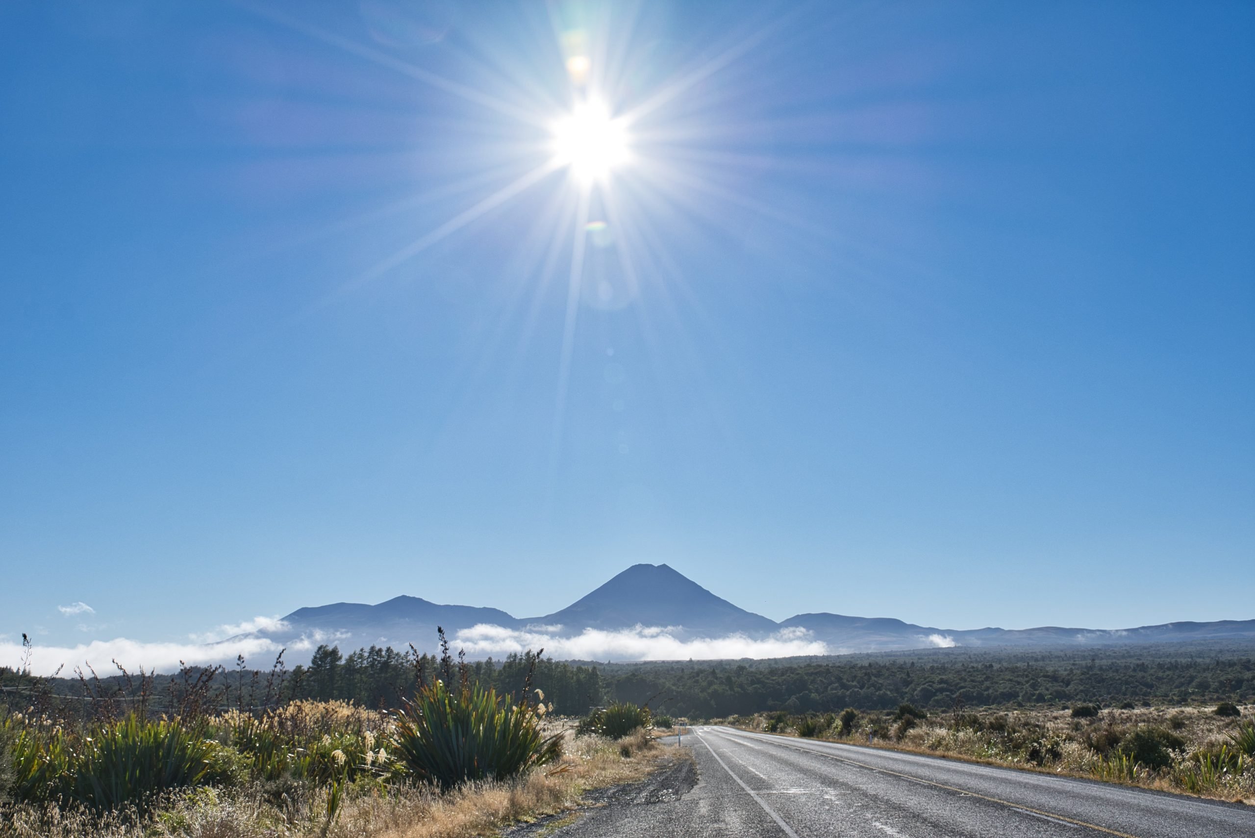
Everyone knows and comes to the Tongariro National Park to do the best one-day walk in the world, the Tongariro Crossing, but that isn’t all Tongariro National Park has to offer. Tongariro National Park provides numerous walks suitable for all ages and fitness levels. You’ll need more than a day to explore them all. You can either drive or catch shuttles from the National Park; your accommodation may also offer this service. Your first stop should be the iSite, where you can get information on the walks. The site also provides information on the history of volcanic activity and the local flora and fauna.

Subscribe to my blog to stay up to date as I share more about my travel experiences.
All prices and times were accurate when this information was written or updated; however, please verify the details on the websites before your visit.
Walks in Tongariro National Park
Whakapapa Village Walks

These first tracks are shorter and the easiest walks in Tongariro National Park, and are located near Whakapapa Village. Although they are easy, the views are still well worth the effort.
The Ridge Track
The Ridge Track is a 40-minute return one-way walk. It’s a great short walk, just 150m up from the Visitor Centre. It’s uphill 600m, but you have great views of Tongariro and Ngauruhoe, especially from two-thirds of the way up. The views are even better from the top, as you can see forever.

The first half of the track passes through the beech forest before opening out into the alpine scrubland. From here, you have steps helping you up the incline. It’s also a popular spot for sunsets.

Whakapapa Nature Walk
The Whakapapa Nature Walk is a 15-minute loop walk that is wheelchair- and stroller-friendly. Here, you can see the park’s unique alpine plants and the surrounding landscape. It starts 250m above the Visitor Centre opposite the fire station.

It has information panels on the area’s plants, and a side track will take you down to the Whakapapanui Stream. The side track has steps and uneven ground, which isn’t suitable for strollers or wheelchairs.

The Mounds Walk
The Mounds Walk is a 20-minute return route and offers excellent views of Mt. Ruapehu and the surrounding area. It’s 5km back down the road and well signposted on the left-hand side. The mounds are giant piles of volcanic debris. You can walk up to the lookout on one of the mounds for great 360° views.

Tawhai Falls Walk
Tawhai Falls is a 13-m drop and a 20-minute return walk. It’s another great one for the kids. It’s located 4km back down the road from the Village. Again, it is well signposted. Although it’s on the right-hand side of the road, you can also park on the left-hand side. One of the best waterfalls, it’s also the location of Gollum’s pool from The Lord of the Rings.
The first lookout at the top of the falls shows the colour of the surroundings and water.

The track is good, but at the river, you have stairs and rocks, which most, including myself, found challenging.


The following are longer walks in Tongariro National Park near the Whakapapa Village.
Whakapapanui Walk
In wet or fine weather, the Whakapapanui Walk is a good option. This walk starts from the same area as the Whakapapa Nature Walk, or 3km back down the road from the Village. It’s a 6km, two-hour walk that can be completed as a loop. You can either return to where you started using the highway or return the same way. You will be following the Whakapapanui Stream, passing through more Beech forest and alpine wetlands.

If you walk back on the highway, you’ll have great views of Mt. Ngauruhoe and Mt. Tongariro to keep you company.

Silica Rapids Walk
Silica Rapids Walk also has two entrances. The first is 250m above the Visitor Centre and should take about 2.5 hours to return. The other is 2.5km up Bruce Road, where there is a car park, which cuts 3km off the 7km walk.
The walk from above the iSite is from the same place as the other two above. On the Whakapapanui Walk, you come to a T-intersection where you can go right to Silica Rapids or turn left for a 5-minute walk out.

There is so much to see on this walk, including a stretch of water known as Golden Rapids. You can also see this on the Whakapapanui Track, but it is more easily visible here.

On this walk, you pass through more Beech forests, sub-alpine plants and wetlands up on the Alpine Bog. Going across the bog, you use a boardwalk, so make sure you stay on it. It is from here that you have a perfect view of Mt Ruapehu.


It’s still about another half-hour after crossing over the Waikare stream, and you haven’t stopped seeing the sights on this walk either
Next is the Rusty Rocks. Back on the boardwalk, you can really see the rust on the rocks. This is caused by the iron in the water and the oxygen in the air.

Not long after, you start to see the yellow mineral-laden waters cascading down and then the terraces of Silica Rapids. From here, you have a lookout over the terraced waters.

After that, you can go up to the Bruce Road, which is only 45 minutes away, and walk down the road and back to Whakapapa Village.
Taranaki Falls
Taranaki Falls features an impressive 20-meter drop. A two-hour loop walk with two entrances, both on Ngauruhoe Terrace behind the Chateau Tongariro. The first on the left-hand side is the Lower Falls Track. This has steps and a rough track, but also offers glimpses of Mt. Ruapehu before heading into the beech forest and walking alongside the stream in parts.

Once you get to the falls, you have great views of the waterfall. It is here that you can go swimming in the pool. If you continue along the track, you will encounter steep steps; however, it is recommended to head to the Upper track instead.

At the top of this track, you can go back or take the track to Tama Lakes. It’s another hour and a half away, and then another hour to the Upper Lake. Remember, if you go to Tama Lakes from here, it will take another 3-4 hours to get back.
The track is much easier on the way back to Whakapapa Village. First, you can see the Wairere stream going down to the falls. The track then leads you past old lava flows and magnificent views of Mt. Ruapehu.

It takes less than an hour to return to Whakapapa Village, with only about 5 minutes in the bush.
Tama Lakes
Tama Lakes is one of the longer day walks, at 5-6 hours. As an extension of the Tama Lakes track, you can do this track after seeing Taranaki Falls.

Once you have reached the turnoff, it’s still an hour-and-a-half walk to the Lower Lake, and it’s all uphill (and stairs) for the next 20 minutes.

Along the way, you pass over small streams that you can jump over or negotiate with a couple of steps. There is a water crossing, and you should check with i-Site to see if there is any or a lot of water crossing here.

When you come across the lower lake, it’s a surprise. After all the walking along the track, you come out onto a large area that looks down on the lake. This is also a good spot to grab a bite to eat.

I didn’t go up to Upper Tama Lake. The climb up isn’t a track, and you follow the poles up to the ridge. No trails lead down to the lakes, and the descent is extremely steep. As you are also in the saddle, the wind goes through strongly, especially if there is a westerly. Be prepared with the required clothing.

You can also try these walks in Tongariro National Park, which goes down towards Ohakune. Here are a few for you to try.
Around Ohakune
There are also walks off the Mountain Road in Okakune.

The Rimu Walk
The Rimu Walk is a 15-minute loop suitable for wheelchairs and strollers. Beginning from the car park, it follows the stream in a forest filled with Ferns and Kamahi.

Information plaques on the plant life in the area are along the track. Large Rimu stands tall, breaking through the canopy.
The Mangawhero Forest Walk
This walk is longer, at an hour, but similar to the Rimu walk, as it starts from the same place. This is a pleasant walk along the Mangawhero River, passing through the bush and tall Rimu trees.

The track ends on the road to the Mangawhero campground, and you can either return the way you came or return along the Ohakune Mountain Road.
Mangawhero Falls
Thirteen kilometres up the mountain road is the short 10-minute walk to Mangawhero Falls.
I was doing all these walks in March (Autumn in New Zealand), and the water was nearly non-existent. Spring and early summer should have more.

There are two lookouts, one at the top of the falls and another a couple of minutes further down, that offer views back at the waterfall. As there was so little water, I took a photo of it, and you can see (or lack thereof) how little there was.

Waitonga Falls Track
Only 11 km up the road is the Waitonga Falls track. At 1 hour 20 minutes, it leads to the highest waterfall in the National Park, at 39 m. Once again, you have beech forests and alpine wetlands that are passed over by boardwalks. You also have great views of the mountains on clear days.

From here, it’s back into the forest and downhill and up stairs until you reach the lookout for Waitonga Falls.

If you wanted to see the falls better, you would have to cross the river and go to the other side.
Turoa Ski-Field
At the top of the road is the Turoa ski field, 1600m above sea level, and the ski field car park. Out of ski season, this place is like a ghost town, but it offers excellent views, especially across to Mt. Taranaki, on the west coast, a couple of hundred kilometres away.

Along with the walks in Tongariro National Park, the area has many historical sites from the pioneering days and later periods. Here is one of the bigger places to stop.
Tangiwai Train Disaster
The Tangiwai Train Disaster is a rest area located between Ohakune and Waiouru, marking the site of New Zealand’s worst train disaster.

This rest stop has information on the train disaster that occurred on Christmas Eve 1953, as well as

I found it very eerie. Whether it was my imagination or because I was the only one there for about five minutes, it is undoubtedly a place to visit to learn about New Zealand’s worst train disaster.
The Whangaehu River carried the lahar from Mt. Ruapehu’s crater lake, which caused this devastation after the deluge weakened the rail bridge.
At 10.21 pm on Christmas Eve, the Wellington to Auckland night train was in the wrong place at the wrong time. One hundred fifty-one people lost their lives that

When you’re in Waiouru, a great place to visit is the National Army Museum. You can find my blog on it here, or more on the North Island of New Zealand here.
This area is rich in history and offers numerous walking trails, making it deserving of more than a one-day visit, especially when you take one of its walks. There are still many more sights to see than I have listed here.
Have You Found This Blog Helpful? Then, Why Not Buy Me A Coffee?
Links
If you’d like to read more of my blog posts about Australia, you can find them at the following links: Queensland, South Australia, New South Wales, Victoria, Camping, and Silo Art. Alternatively, if you’re interested in New Zealand, the United Kingdom, or Photography, you can click the links for each.
Travel Resources
- All-in-One Travel App—Klook is for all your travel needs, from tickets and attractions to SIM cards and fast-track through customs and immigration.
- Flights & Accommodation—You can search for the cheapest flights and accommodation using AviaSales, Booking.com, or Tripadvisor.
- Car Hire—In Australia, you can use Budget Car Rentals Australia or Avis Car Rentals Australia or in New Zealand, Budget Car Rentals New Zealand or Avis Car Rentals New Zealand.
- Camper & RV Rentals—Want a quieter pace exploring Australia and New Zealand in your own accommodation? Jucy Rentals and Star RV Rentals will give you an unforgettable travelling experience.
- Travel Insurance is the number one thing to pack when you’re travelling. Cover-More Australia, Cover-More New Zealand, EKTA, Travel Insurance Master, and Insubuy provide insurance coverage during your travels.
- Attractions—buy before you leave home with these great sites: Big Bus Tour, GetYourGuide, GoCity, and Viator.
- SIM cards—Try Airalo, the world’s first eSIM store, which solves the pain of high roaming bills by giving travellers access to eSIMs (digital SIM cards).
- Power Stations—Bluetti Australia Power Stations are your choices for sustainable, eco-friendly power on the road or at home.
- For more tips, try my Travel Links and Resources page.
Did You Like This Post? Then Pin It!


Beautiful photos with a wonderful write up explaining each place. Makes you want to go and visit.
Thanks Joan. Personally, I think everyone should visit at least once.
I’ve read so much about the Tongariro Crossing that I’ve never really considered there are many other alternative walks in the National Park. The Ridge Track in particular sounds great with the views of the Tongariro and the Ngauruhoe as you go up. The Tawhai Falls Walks looks great too with the view of the falls. Though, I’m not a fan of stairs. LOL.
Thanks Marvi. All the walks are great but they all have some stairs. What I find helps is just using one hiking pole. It’s much easier on the knees and a great help balancing over rocks and getting up a high step.
I recently enjoy walking / hiking when I’m on holidays. Definitely bookmarking this post for my future NZ trip ! Good to know that you can swim in waters below the Taranaki Falls !
Thanks Jeremy. Not only can you swim at Taranaki Falls but I just remembered that some guys were swimming at Tawhai Falls as well.
I love doing walks and day-hikes on my vacations, so this sounds like something I would definitely pick if I were in the area. I love how you’ve added in so much detail, including which trails are suitable for those with kids or those with mobility challenges. Thanks for sharing!
Thanks Neha. It’s definitely somewhere I’d go back to as it would be different at different times of the year.
Oh, New Zealand looks so beautiful! I love it when National Parks have a wide choice of well-marked hikes so that everyone can meet their needs and there is lots of variety depending on the energy level of the day! I would love to hike to the Taranaki Falls.
Thanks Alion. It really is as beautiful as it looks and I hope you get to do the walks especially the Taranaki Falls one day.
I’m not an avid hiker, so I like where there are many trail options. Tawhai Falls Walk looks beautiful and I love walks that have waterfalls. It’s a quick hike and although the rocks and stairs seem challenging I think I could manage this one 🙂
I am not fit at all Candy and these walks that I did are easy enough for average fitness. I also use one hiking stick just for balance and helping get up high steps.
Tongariro looks stunning! The landscape is lovely and those waterfalls and pools look so welcoming. The trees and the dappled sunlight add to the beauty of the park. Of course, we’d love to hike there 🙂
Thanks Mohana and Aninda. I hope that you get there one day and it’s as beautiful as when I was there.
Tawhai Falls Walk has my eye, simply because it takes you to the location of Gollum’s pool from Lord of the Rings…that sounds like a winner! And I love the fact the track gets a bit more rocky and challenging. My kind of trek.
You’d love the walk, Michael. All the men were all over the rocks, even the ones on the right-hand side of the photo and diving into the pool from there.
I find it really intriguing that you can walk in the national walk. The ones we have in India are generally wildlife national parks and we can’t get down the car fearing getting mauled by a wild animal. Tongariro looks like a great choice for small treks.
It’s a great place to visit Ketki. There are no wild animals in New Zealand, in fact, we are hoping to be pest free by 2050.
What a delight to read so many interesting things to see it would be a wonderful place to visit the photos were amazing you certainly took me on a journey through the national park
Thanks Kathy. There are walks that you could manage there and it is a great place to visit. I’ll definitely be going back.
WOW! The Tongaririo National Park looks like a beautiful place to have a walk or hike! We’ve never heard of this park so would definitely love to explore it someday. Thanks a lot for sharing this!
Thanks Mei and Kerstin. I hope you get a chance to visit one day.
We’ve not managed to make it up there just yet but it’s on our list for when we head up to the North Island! This is such a great guide to so when we do get there we will know exactly where to go and what to do! Cheers!
Thanks Nicola. I hope you enjoy your time there when you make it.
[…] 14 Easy Day Walks in Tongariro National Park […]